Get a 15% discount on Saily eSIM data plans! Download Saily app and use code "notjustbikes" at checkout.
https://saily.com/download-esim-app/
Made by humans for humans. No AI voices or generative AI was used in the making of this video.
Check out my new public transit travel show, Day Pass, now available on Nebula!
https://nebula.tv/daypass?ref=notjustbikes
Watch this video ad-free and sponsor-free on Nebula:
https://nebula.tv/videos/notjustbikes-i-climbed-the-highest-mountain-in-the-netherlands
Patreon: https://patreon.com/notjustbikes
Mastodon: @notjustbikes@notjustbikes.com
NJB Live (my live-streaming channel): https://youtube.com/@njblive
---
Relevant Videos
This Tiny Island has Insane Traffic
https://nebula.tv/videos/notjustbikes-this-tiny-island-has-insane-traffic
https://youtu.be/kdz6FeQLuHQ
西久靈 visited the highest point in *every province* of the Netherlands:
https://www.youtube.com/watch?v=NcFDdRg9ZBg&list=PLlu-xvtgN9FfClYft5Fgwda0p9_MGfhSS
---
References & Further Reading
Sid Meier's Pirates! (1987)
https://archive.org/details/msdos_Sid_Meiers_Pirates_1987
By scanned bill from my wallet, Fair use, https://en.wikipedia.org/w/index.php?curid=22343765
By bill taken from wallet. Originally created by the Central Bank of the Netherlands Antilles, Fair use, https://en.wikipedia.org/w/index.php?curid=24240921
House on the Path, Windward Side, Saba
https://www.remaxislandproperties.com/house-on-path-villa-sale-windward-side-saba-for-sale
https://www.youtube.com/watch?v=pjpu8oQ5gjM
Netherlands Antillean guilder
https://en.wikipedia.org/wiki/Netherlands_Antillean_guilder
The Road Which Could Not Be Built
https://thesabaislander.com/2016/01/12/the-road-which-could-not-be-built/
By ikarus78 - Own work (Original text: self-made), CC BY-SA 3.0 de,
https://commons.wikimedia.org/w/index.php?curid=37103709
Helicopter for Mt. Scenery Tower Project Arrives on Saba
https://www.sabagov.nl/news/helicopter-for-mt-scenery-tower-project-arrives-on-saba
Phase 2 Saba solar park project well on its way to completion
http://sabanews.nl/2018/12/04/phase-2-saba-solar-park-project-well-on-its-way-to-completion/
https://www.re.powerupsaba.com/
Saba Solar Parks - The Green World Company
https://www.youtube.com/watch?v=XbXQv5BvWPM
Clean energy for EU islands - Saba
https://clean-energy-islands.ec.europa.eu/countries/netherlands/saba
https://clean-energy-islands.ec.europa.eu/resources/publications/saba-roadmap-smart-energy-
system
Saba and RMI Formalize New Project to Reach Nearly 90% Renewable Energy Production
https://rmi.org/press-release/saba-and-rmi-formalize-new-project-to-reach-nearly-90-renewable-energy-production/
The road that couldn’t be built
https://www.caribbean-beat.com/issue-179/the-road-that-couldnt-be-built-on-this-day
Saba Island Express
https://www.sabagov.nl/news/public-entity-saba-introduces-island-express-a-new-public-transportation-service-for-the-saban-community
https://www.sabagov.nl/residents/transportation/bus-schedule
https://www.sabagov.nl/residents/transportation/bus-schedule/island-express-1
Mount Scenery Tower Replacement to Begin
https://www.sabagov.nl/management-organization/office-of-communication-public-relations/public-entity-saba-newsletter/february-2026
Sikorsky S-64 Skycrane
https://en.wikipedia.org/wiki/Sikorsky_S-64_Skycrane
By WikiPedant - Own work, CC BY-SA 4.0, https://commons.wikimedia.org/w/index.php?curid=60334655
By WikiPedant - Own work, CC BY-SA 4.0, https://commons.wikimedia.org/w/index.php?curid=60334447
CN Tower Construction 1975 S-64 Sikorsky
https://youtu.be/MTB2YX6NOl8
This video uses stock footage from Getty Images and other licensed sources.
Оглавление (5 сегментов)
Segment 1 (00:00 - 05:00)
Today we are setting out on an epic adventure. To climb to the absolute highest point … in the Netherlands. To achieve this heroic feat we will need to travel over two hours by train from Amsterdam to the border town of Heerlen. Then continue on bicycle for a grueling 22 kilometres up-hill, Until we finally reach Vaalserberg, the highest point in the Netherlands at a whopping 322. 4 metres above sea level. It’s going to be a long journey... [jingle! ] [clank! ] so let's get started... [bicycle ASMR] [transit ASMR] [beep! ] [transit ASMR again] [Day Pass Cameo] [transit ASMR, continued] [Walking ASMR] [because you're not allowed to bike here] [bicycle ASMR] [Limburg edition] Ahh. Whew. Almost there... We did it, chat! We made it to the highest point in the Netherlands! Woo-hoo-hoo! ah, hah... But … wait … why isn’t this video over? [NJB Intro] [ding ding! ] The Netherlands is a small country in Europe, but for several centuries the Dutch had colonies around the world, including the Caribbean. Especially after the Dutch West India Company was founded in 1621. Which was the same year that the Netherlands declared war on Spain, And so the Dutch West India Company pretty much immediately started plundering Spanish ships, in the Caribbean, As well as conquering Spanish islands, such as Curaçao which became one of the largest distribution hubs of slaves from Africa. After several centuries of history I feel nowhere near qualified to talk about because this is not a history channel, The Dutch ended up owning several islands in the Caribbean that were collectively referred to as the Netherlands Antilles. These islands were not technically part of the Netherlands, but they were considered a constituent country in the Kingdom of the Netherlands. Technically England, Scotland, Wales, and Northern Ireland are also constituent countries of the United Kingdom of Great Britain and Northern Ireland, but they’re a lot more integrated than the Netherland Antilles was to the rest of the Netherlands. But regardless, there were many people who were very unhappy about this situation, especially on Arubu, which became an independent constituent country in 1986. This ultimately resulted in referendums across the other islands, and in October of 2010, the Netherlands Antilles was officially dissolved. Curaçao and Sint Maarten voted to become independent constituent countries, like Aruba. While Bonaire, Statia, and Saba voted to become part of the Netherlands. As a result, these last three islands are no longer constituent countries, they are now part of the Netherlands. The legal term is openbare lichaamen, or public bodies, which is exactly the same legal classification that this chunk of reclaimed land had before it became the province of Flevoland. And I’m telling you all of this because it means that the highest point in the Netherlands is not this 322. 4 metre hill, It’s the 870 metre high Mount Scenery, on the island of Saba. Which you can hike to from here. So let’s get started, and I’ll tell you about Saba on the way. Saba is an island in the Caribbean, located right about here. The entire island is only 13 square kilometres in size, And just over two thousand people live here, which makes Saba the smallest territory in the Americas by population. Incidentally, whenever I’ve heard someone in the Netherlands, that is, the mainland Netherlands, speaking about the island, they call it Sah-bah, but everyone I spoke to on the island called it SAY-bah, so that’s what I’ll call it. In case you’re ever confused, just remember it rhymes with [SEGA] We were staying in Windward Side, the second-largest town in Saba And you will be shocked to learn that it is located on the windward side of the island. But most importantly, the trailhead to the Mount Scenery hike is located right at the edge of town. Most of the hike up Mount Scenery is on steps like these. There are apparently 1064 steps but I didn’t count them, so I might be guilty of spreading misinformation on the Internet. Oh, and I noticed that this cottage, located a short way
Segment 2 (05:00 - 10:00)
up the hiking path, is currently for sale. The asking price is 525 thousand US dollars. Uh, contact Jeff if you’re interested. Despite being part of the Netherlands, the official currency of Saba is the US dollar. They used to use the Netherlands Antillean guilder, but after the Netherlands Antilles was dissolved in 2010 that currency couldn't be minted anymore. Since the exchange rate of the Antillean guilder was already pegged to the US dollar and the economy of all the islands depended a lot on American tourism, the easiest thing to do was to just use the US dollar until a better solution could be found. Curaçao and Sint Maarten developed a new currency called the Caribbean guilder, which was introduced in 2025. But Saba and the other islands switched to the US dollar and have never adopted anything else. By contrast the French side of nearby Saint Martin uses Euros. This small stone structure along the hike is kinda interesting. It reminds me of the one we found in the forest in the first episode of Day Pass. The path splits off into multiple different hiking trails here. We’re going to the right though, to the top of Mount Scenery! Now the hiking trail runs along this road for a while. You could start hiking from here if you really wanted to, but it doesn't really save you much time, and it kinda spoils the fun of walking from town. The main road around Saba is very steep and winding, and the story of how this road was built has become a foundational story on the island. Before the road, people would get between towns by walking up stone steps, carrying heavy items by donkey, and development on Saba was far behind the rest of the Netherlands Antilles as a result. So there was a strong desire to build a road, but when Dutch engineers were brought to the island in the 1930s they said that it would be impossible to build a road here. Presumably because the elevation was higher than 322. 4 metres. One Saba resident named Josephus Lambert Hassell, known on the island as “Lambee”, was not satisfied with this answer. So he signed up for a correspondence course by mail and taught himself engineering. Then he and dozens of other Saba residents all got together to build the road themselves. And I love the photos of how they delivered the first motor vehicle to the island. Sabans now refer to this as “The Road that Could not be Built” And there’s this sign explaining this on the side of Lambee’s house, which was recently converted into a café. Well, that’s the story anyway, and it’s mostly correct but the truth is a little bit more nuanced. This road to the harbour was engineered by the Department of Public Works on Curaçao. And it’s not so much that the Dutch engineers said that building the rest of the road would be literally impossible, so much as it would be extremely difficult and prohibitively expensive, and most importantly, that the government wasn't willing to pay for it. But Lambee and his fellow Sabans did genuinely design and build the other roads on the island by themselves, and without any machinery, which is incredibly impressive, and deserving of legend. As for the road along the hiking path, it just goes by Some public gardens, As well as these greenhouses. This is called Gezondheid Farms which is what I would expect from Saba. One Dutch word, one English word. Saba is a strange mix of American influence and Dutch influence. Children learn both languages at school, but English is by far the dominant language on the island. About a third of the population speaks Dutch, but nearly everyone speaks English. We stayed at the Cottage Club Hotel in Windward Side. That had some great views of the mountains and the sea, And you can tell that they’re Dutch because the brickwork of the klinkers is really well done. Windward Side is fairly small and everything was within easy walking distance, which was nice. There were several shops and restaurants, A playground, And two grocery stores that were surprisingly well-stocked. The grocery store was funny, because the shelves had many products commonly found in Dutch grocery stores, Mixed in with the rest of the items from North America. So of course I had to pick up some Nederlandse drop. It was also weird to be on an English-speaking island in the Caribbean, And see very Dutch-looking police and fire vehicles. After leaving the greenhouses the path continues, and there are no more buildings until the top. The number of different kinds of trees and vegetation along the path is amazing. If I knew anything about it I would tell you something about it here, but I don’t, so I won’t. The hike up to Mount Scenery is not particularly difficult, but it is tiring, And I preferred climbing the parts that were just a steady ramp up than the parts with stairs. Although I find it difficult to complain at all about a hike like this when I know that somebody once had to climb up this hill and build the stairs as they went.
Segment 3 (10:00 - 15:00)
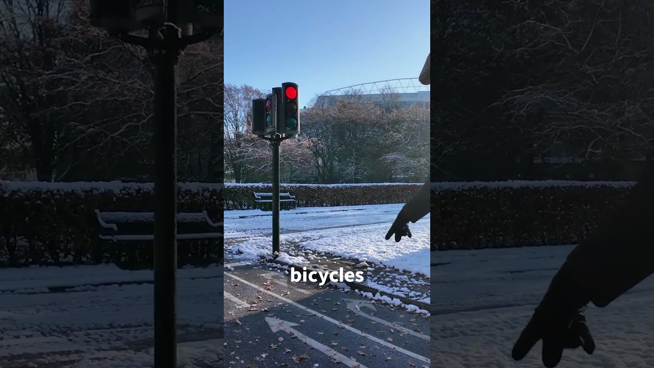
These stairs might look like they’ve been here for centuries but they were actually only built in the late 1960s. Oh, nice, a bus shelter. I’ll take transit the rest of the way up. Unfortunately, Saba is very car-dependent. A public transit route was launched in 2024, but it is only available to residents of Saba. And I’m assuming that this bizarre schedule would make sense to you only if you actually lived here. Of course, the towns are very small, and you can easily walk to where you’re going in a few minutes. To get between towns, we mostly took taxis, which sounds fine, but in reality, it was a giant pain in the ass. There aren’t a lot of taxi drivers on Saba, so whenever a flight would come in most of them would be busy with airport pickups. So there were a few times where I couldn't book a taxi to get where I wanted to go. Like when I needed to make it to my scheduled boat trip so that I could film the island from a distance. So I had to walk along the road which really sucked. There’s no sidewalk and some people drive really fast. This was definitely the worst part about staying on Saba. But this car dependency is typical of most islands in the Caribbean. A few years ago I made a video about Nassau, the capital of the Bahamas, and I talked about how bad the traffic was, despite being on an island that’s smaller than the city Amsterdam. We also visited the nearby island of Sint Maarten, and the traffic there was absolutely ridiculous, especially given the population. And some of the walks I did there were so bad it made me wish I was back in Houston. As I always say, there’s no solution to car traffic except viable alternatives to driving, and since these islands don’t have any viable alternatives, everybody drives. Saba has less than a tenth of the population of The Bahamas, so the traffic was nowhere near as bad, but I did find it annoying that there was an almost constant flow of cars through the middle of Windward Side on weekdays. But at least they had speed bumps to keep people from driving too quickly through town. So what Saba really needs to do is to stop talking to those Dutch engineers and get some Swiss engineers in here to build some trains, trams, and funiculars. I’m sure you can get some EU funds to pay for all that, right? I was pleased though to see that the cars in Saba were mostly small cars. It was nice to see that the disease of oversized SUV hasn’t infected the island yet. It was also interesting to see that the license plates were Saban and not Dutch. For example, cars on the French side of Saint Martin do have EU license plates. I saw many small pickup trucks like these, which are very similar to the K-trucks that are common in Japan. And some of them even had right-hand drive, and were likely imported from Japan. I saw some larger pickup trucks as well, but amazingly, people were actually using them for their intended purpose of hauling things, which is pretty rare to see these days! In most other countries, pickup trucks are primarily driven empty by insecure assholes. Especially in the rest of the Netherlands. And the cars were pretty beat-up and well-used, too. I assume it's difficult to get a car repaired or replaced on an island like this. I didn’t see anybody riding a bicycle on Saba, which isn’t too surprising as everything in town is easily accessible on foot and the hills are quite steep. But I wouldn't even want to ride an ebike here because the road is not very safe for cycling. I would love to see what this island would be like proper safe Dutch-style road design, but we all know that's not going to happen. At this point in the climb we’re entering the cloud forest. As humid air is forced upwards by the steep slope of the mountain, the water condenses, and so the top of Mount Scenery is almost always covered by clouds. Here is one of the rare times I managed to catch it when it was clear. But there is a great view of The Bottom from up here, if you can catch a break in the clouds. The Bottom is the largest town on Saba, but it’s still not a very big town and you can easily walk from one end to the other. Despite its name, The Bottom is not actually at the bottom of the island. It was originally called De Botte by Dutch colonists, which means “the bowl”, because its location is like a bowl between mountains. Which makes more sense. We were there during their King’s Day celebration, where they opened one street to people and lined it with tents. It was funny to see people celebrating Dutch King’s Day, While barbecuing and listening to Caribbean music. Saba is an interesting place. Sometimes it feels American, sometimes it feels Caribbean, and sometimes it feels Dutch. And the banks are Canadian Whew. This is a good time to stop for some water. This hiking trail is in Mount Scenery Nature Park, which became an official Dutch national park in 2019. The mountain we are climbing is a dormant volcano.
Segment 4 (15:00 - 20:00)
The last eruption happened shortly before the first European settlements in the early 1600s, but it could become active again. Because this island is effectively a volcano, Saba doesn’t have the sandy beaches found on other islands in the Caribbean. The coastline is mostly rocky cliffs over 100 metres tall. This made the island a favourite hideout for pirates in the 1600s. Like most tourists, we arrived in Saba by airplane. And this photo I took through the cockpit window makes it look like we’re flying straight into a mountain. The airport on Saba has the shortest commercial runway in the world, at only 400 metres long. And it immediately drops off of a cliff and into the sea at the end, which limits what type of planes can land on Saba, It’s mostly serviced by Twin Otter propeller planes, made by the Canadian company De Havilland. These types of planes are designed for use in extreme environments, This one literally has skis on it and flies to Antarctica. How freak’n cool is that? We arrived by plane, and the landing was, uh, quick. It would’ve been fun to fly out of Saba too, but we left by ferry. Which was fine. There was lots of space and it didn’t rock around too much. But if you do need them, the barf bags were much fancier than what you find on a typical airplane. The ferry was on time and the trip took about an hour and fifteen minutes to get to Sint Maarten. The airport on Sint Maarten is famous as well, but for totally different reasons. Outside of the airport on Saba is this solar farm that was completed in 2019. And the solar panels were designed to withstand a category 4 hurricane. There are two solar parks with batteries on Saba that provide 40 percent of the island’s electricity, With the rest being generated mostly by diesel generators. Saba Electric has more solar parks under construction and plans to stop using fossil fuels entirely by 2030. As you might expect, tourism is the largest sector of the Saban economy, but mass tourism has not yet come to Saba, which is why the island is referred to as the "Unspoiled Queen" of the Caribbean. Apparently there are some great diving locations here, too. Though I didn’t have a chance to do any diving, as I mostly just came here to hike this mountain for your entertainment. Once we get into the cloud forest, the steps start getting a little bit steeper. Ah, finally. A railing. I guess this part of the hike complies with EU safety standards. But seriously, the railing, while not really necessary, does make the stairs less of a chore. After a lot more stairs we finally get to this bench. And it’s possible to see the communications tower at the top of Mount Scenery for the first time. This tower was originally built in the 1970s as a microwave relay station to nearby islands, but it was aging and needed to be replaced. So a few weeks before we arrived, the Dutch Ministry of Defense started a project to replace the tower, which we only learned about after arriving on the island. The project involves dismantling the tower, By workers who have to make this climb every morning. And then a helicopter is used to pick up the pieces of the tower. And deliver them to this ship, moored offshore. This is quite a complicated operation, and complicated further by the fact that the helicopter pilot needs to see what he’s doing. So we would occasionally see them quickly fly up to the top of the mountain whenever there was a break in the clouds. And apparently that’s happening right now, because here comes the helicopter. This is a Sikorsky S-64F Skycrane and they’re really interesting machines so it’s great to see one of them up close. Each one of these helicopters is given a unique name. This one is called “Camille” and it was built in 1970. The Skycrane named “Olga” was used in the construction of the CN Tower in Toronto in 1975. I love helicopters and I wanted to become a helicopter pilot when I was young, but it’s horrendously expensive to get a helicopter pilot’s license so I only ever took one trial lesson. Back on Saba, the helicopter makes it to the tower, but the clouds roll in again. It looks like they might be trying to push away the clouds with the helicopter blades, but it’s not working. And after a few minutes of trying they abort and head back to the airport. And once again it’s quiet on the hiking trail. The path now goes down hill, but there’s a sign here showing that it’s this way to the highest point, so let’s go! The ground here is really slippery, so I’m glad there’s a railing. But once we get to the bottom, there’s a sign saying that the path is closed, and workers are turning people back if they go through. We heard that the wind from the
Segment 5 (20:00 - 23:00)
helicopter had knocked down some trees and it was unsafe to go along this route while the helicopter was operating. There is another hiking trail here called the Elfin forest trail which looks nice, But we’re trying to get to the top so let’s turn around and head back up the hill, To take the alternate route. The first part of this trail has muddy wooden stairs, with some wire mesh on them to make them slightly less slippery. But you really have to watch your step. But then we get to this part which is just a path of wet mud with some boards dropped down to make it slightly easier to walk on. And it just gets worse from here. There are a few sections along the way that require some climbing. But it’s not too difficult and some parts have ropes to help. And finally, after one more flight of wooden stairs, we make it to the peak. There's a concrete post here to mark the highest point. And if you wait for a break in the clouds you can get a fantastic view from up here! I knew the islands in this region were close together, but it still surprised me how easy it was to see one island from another. This is Saba, as seen from the shore of Sint Maarten. And this is Statia seen from Saba. But back up on the peak you can see the tower that they’re dismantling. And if you look really carefully to the left of that, you can see... the actual highest point in the Netherlands that we can’t get to because of the helicopter. Damn it. Clearly I’m going to have to come back to Saba and try it again some time. Of course that next trip would be a lot easier if they at least had some public transit. But one thing that did make my trip easy was having reliable mobile phone service. Which is why I was glad to have Saily, the sponsor of this video. Saily lets you buy an affordable data plan on your phone, so you can save money on expensive roaming fees. I find it an absolute necessity to have a good data connection on my phone when I travel. In case I need to, maybe, text someone for help when I slip and fall while hiking. Back in the olden days, I used to have to find a local shop and buy a pay-as-you-go SIM card, which wasn’t always easy in a new country. But with Saily you just choose your plan and install your eSIM in the app before you leave, And a few minutes after you arrive your eSIM automatically activates and you’ve got a high-speed data connection. Saily offers affordable eSIM plans for over 160 countries, as well as 8 different regions. This was incredibly convenient for my trip because Saily had a single eSIM package for the Caribbean. Which included Saba as well as all of the other islands I visited. Which was great because if I had to get a different SIM for each island it would've been much more expensive. Saily lets you choose how much data you want to buy, so you can choose the right amount for the length of your trip. And I also like that I only have to install the Saily eSIM once and it works for every country. Which is going to be incredibly useful next month when I’m filming six new episodes of Day Pass across multiple countries in Asia. I can tell you from experience that having a reliable and fast internet connection makes travelling so much easier, so if you’re planning to travel, I strongly recommend you try out Saily. Just follow the link below to download the Saily app and use the code “notjustbikes” at checkout to get 15% off a Saily eSIM data plan. Thanks so much for watching, and thanks to Saily for sponsoring this video.